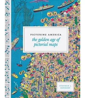
Pictorial maps are artistic renderings rather than scientific representations of places that combine cartographic elements with texts and images and feature bold and arresting graphic design,
bright and cheerful colors, and lively detail: think Saul Steinberg’s famous New Yorker cover, View of the World from 9th Avenue. In the United States, the period of the 1920s through about
1970 represented a golden age for the form, with thousands of innovative pictorial maps mass-produced for use as advertisements or decorative consumer objects. This book is the first to
consider pictorial maps as a distinct genre. Following an introduction by historian and collector Stephen Hornsby, it features 158 pictorial maps organized into six thematic sections, ranging
from ?Maps to Amuse” to ?Maps for War,” all of them in full and glorious color. The book is published in association with the Library of Congress, which has extensive holdings in pictorial
maps.